



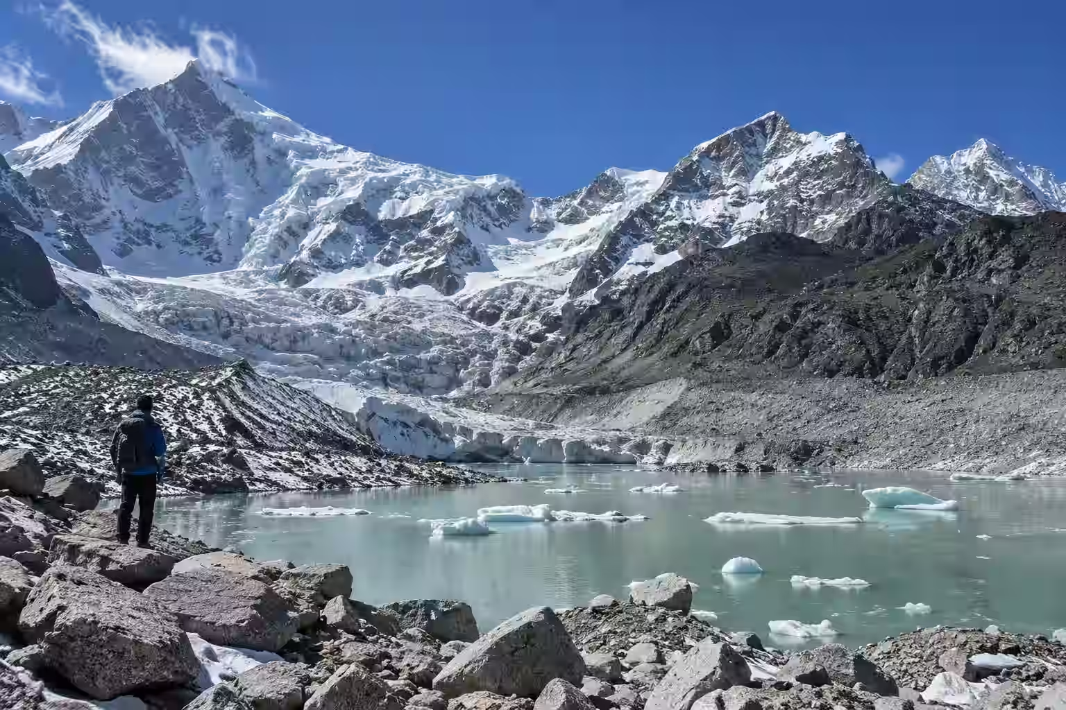
High in the mountains of Sikkim, far above the towns and villages of the Teesta valley, dozens of glacial lakes are now being watched more closely than ever.
The state has identified 40 glacial lakes that require detailed investigation because of the danger they could pose downstream. Sixteen have been placed in the highest-risk Category A, as scientists and disaster-management teams step up efforts to prevent another devastating Glacial Lake Outburst Flood, or GLOF.
The warning carries particular weight in Sikkim.
In October 2023, an outburst from South Lhonak Lake sent an enormous volume of water through the Teesta basin in the middle of the night. The flood swept through settlements and infrastructure, destroyed the Chungthang dam and caused destruction across several districts.
Nearly three years later, that disaster continues to shape how the state looks at the lakes forming and expanding in its high mountains.
At a GLOF risk-mitigation workshop in Gangtok this week, Sikkim’s Department of Science and Technology said there are more than 400 glacial lakes across the state. Forty were selected with the National Disaster Management Authority for detailed investigation after scientists examined their growth patterns and the possible impact on areas downstream.
Of those, 16 have been identified as high-risk Category A lakes which is getting to them is itself a challenge.
Many of the vulnerable lakes lie at elevations of around 17,000 feet, or more than 5,000 metres above sea level. Some can be reached only after difficult expeditions through remote Himalayan terrain. Three of the identified lakes, including two above Gurudongmar and North Lhonak, are considered inaccessible even on foot.
Scientists have nevertheless completed detailed assessments for 13 of the high-risk lakes.
The work goes much further than looking at satellite photographs. Teams are measuring the depth of the lakes, studying water levels and discharge, examining the geological structure of the natural dams holding the water back and modelling what could happen if one of those barriers failed.
Electrical Resistivity Tomography, bathymetric surveys, DGPS measurements, hydrological monitoring and geophysical investigations are among the techniques being used.
A multidisciplinary expedition carried out between July 23 and August 8 this year took scientists into Mangan district to gather fresh data from vulnerable lake systems. Researchers from the state government, Sikkim University, the Central Water Commission, Brahmaputra Board and other institutions took part, with operational support from the Indian Army and Indo-Tibetan Border Police.
The aim is not simply to identify which lake looks dangerous. The officials want to know how much water a lake holds, how stable the material around it is, what lies downstream and how a flood would move through the valleys if the lake suddenly released its water.
That distinction matters because no two lakes present exactly the same problem.
Sikkim Principal Secretary Sandeep Tambe said the state cannot apply one solution to every lake. Instead, authorities are developing separate mitigation plans for some of the most vulnerable areas, including Shako Chho, the Lhonak complex and the Gurudongmar complex.
Shako Chho is receiving particular attention. A detailed project report for mitigation work at the lake has already been submitted to the Government of India.
For the Lhonak complex, authorities are examining a nature-based flood-retention system at Dolma Sampa, around 25 kilometres downstream. The area covers roughly 300 hectares and naturally helped slow the 2023 flood. Engineers are studying whether that landscape can be used more deliberately to reduce the force of a future outburst.
The Gurudongmar complex presents a different problem.
Officials say it covers more than 320 hectares and holds an estimated 178 million cubic metres of water. Because Gurudongmar is also a place of deep religious and cultural significance, any engineering intervention has to consider both safety and the sensitivity of the site.
A retention structure near the source is among the measures being examined. Early warning is the other major part of the state’s strategy.
Monitoring stations have already been installed at locations including South Lhonak. The Central Water Commission has proposed another 10 early-warning systems in Sikkim, while dam operators are also required to maintain warning systems of their own.
These systems cannot stop a lake from bursting. What they can potentially provide is something Sikkim did not have enough of in October 2023: time.
Minutes can matter when a wall of water is moving down a narrow Himalayan valley.
The 2023 disaster struck around midnight. Roads, bridges, homes and hydropower infrastructure were caught in the flood. Sikkim officials now estimate the damage from that event at around ₹18,555 crore — greater than the state’s annual budget at the time.
That experience has pushed the state beyond simply monitoring the glaciers.
Officials are considering ways to physically reduce the danger at individual lakes. Options include siphoning or pumping water, improving natural drainage channels, constructing artificial channels, strengthening moraine barriers and building structures capable of retaining part of a sudden flood.
Sikkim is also working towards a dedicated GLOF risk-mitigation protocol that could eventually provide a common scientific framework for assessing and responding to glacial hazards.
The urgency extends beyond one state.
Across the Himalayas, glaciers are retreating and the landscape around them is changing. Meltwater can collect behind loose rock and ice left by retreating glaciers, creating or enlarging lakes at high altitude. If the natural barrier holding one of those lakes fails because of erosion, an avalanche, landslide or another trigger, the water can rush downstream with extraordinary force.
Recent disasters elsewhere in the Himalayan region have brought that danger back into focus, although not every glacier-related flash flood is a GLOF.
For Sikkim, the threat is no longer theoretical. South Lhonak showed what can happen when a high-altitude lake, almost invisible to people living kilometres downstream, suddenly becomes a disaster moving through the valley.
The work now underway in the mountains is an attempt to make sure the next warning comes before the water does.